By Tice Supplee, Director of Bird Conservation, Audubon Arizona
Audubon Arizona received a 2018 SJV Awards Program grant to develop a GIS based habitat prioritization model for the Yuma Ridgway’s Rail (Rallus obsoletus yumanensis), a subspecies of the Ridgway’s Rail, and a federally endangered species. A small population occurs on the Gila River in Maricopa County, Arizona, west of the Phoenix metropolitan area within the Lower Salt and Glia Rivers Ecosystem Important Bird Area. This often forgotten “secretive marsh bird” is persisting in the face of urbanization, water diversions, and increasing recreational activity. Audubon Arizona began speaking up at Gila River riparian restoration and recreational development meetings about the value of emergent marsh for Yuma Ridgway’s Rail, and the need to incorporate these areas into conservation planning efforts.
A recent publication by Glisson et al. 2017 presented a United States habitat prioritization model for the species, which sparked the idea of refining the model to map important habitat along the Gila River. We quickly encountered the challenge that emergent marsh was so small and scattered in distribution that it did not show up in any wetlands or riparian habitat mapping. So, now what?
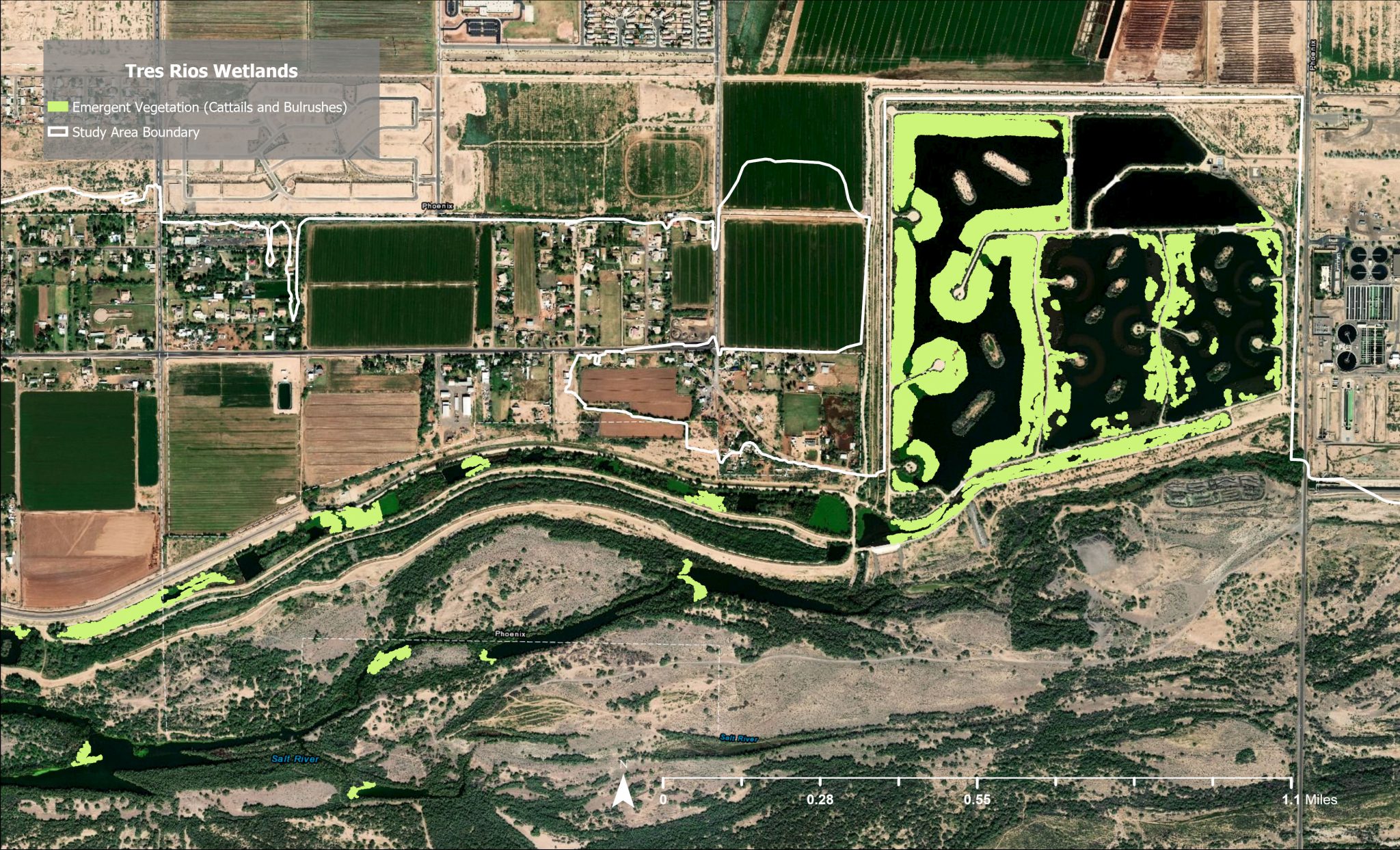
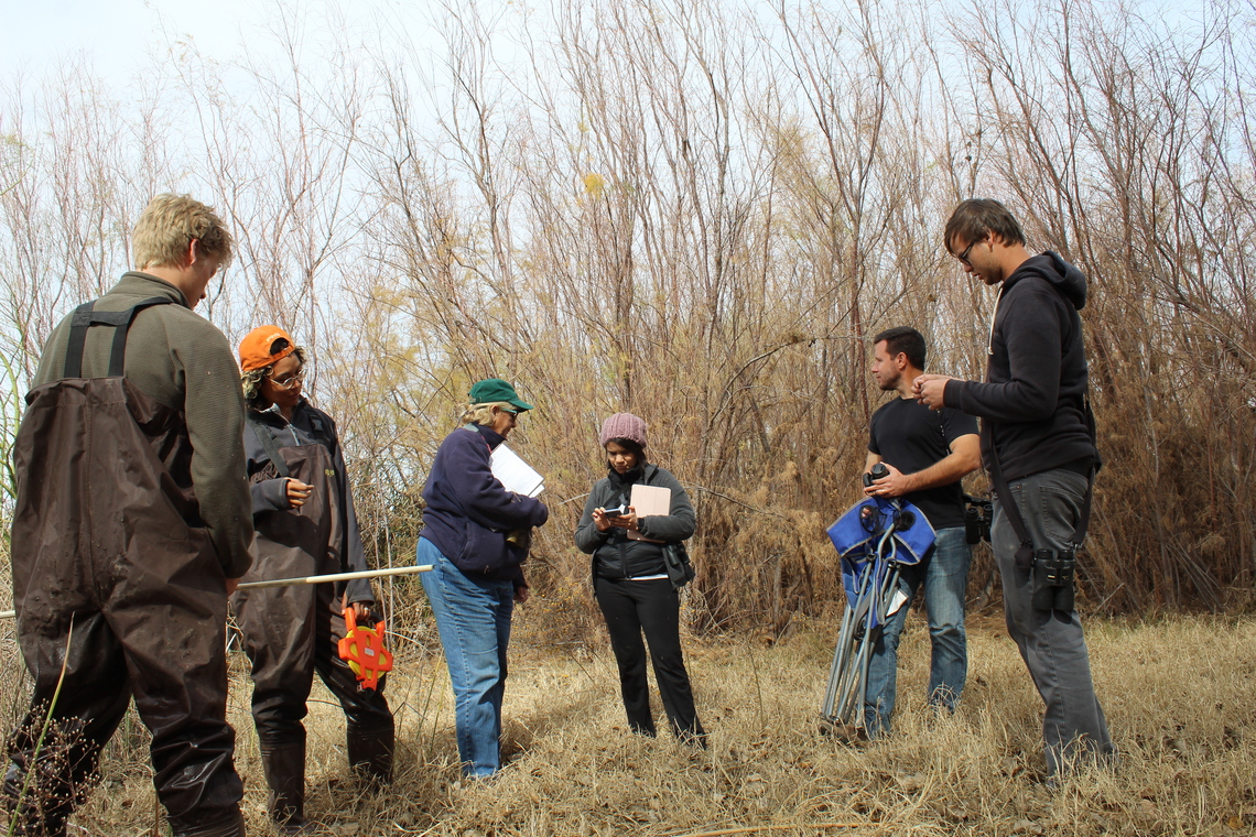
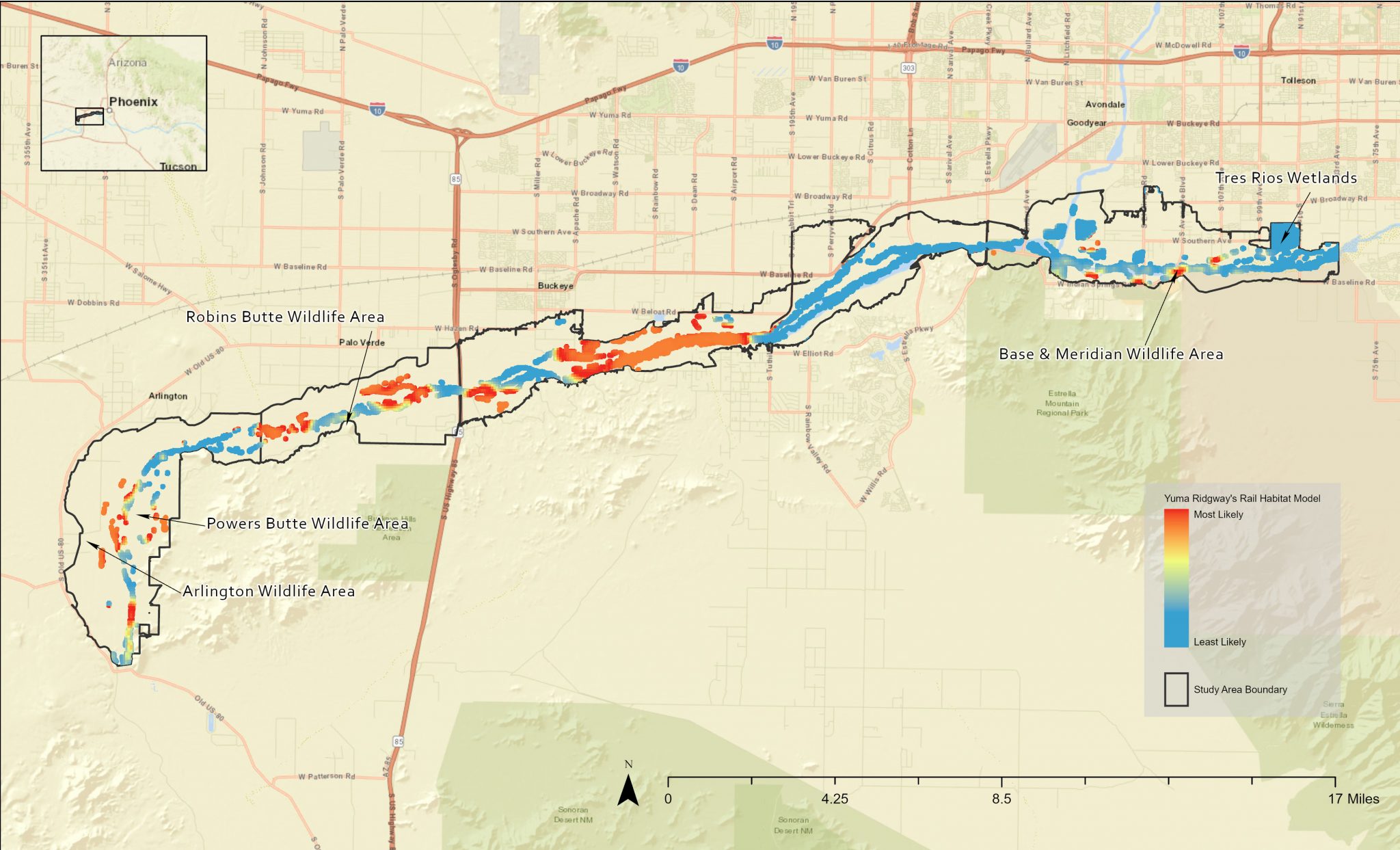
A recently developed machine learning tool developed by Esri called “Segmentation” proved to be the answer. Using National Agriculture Imagery Program (NAIP) imagery from 2017, we created a local map of emergent marsh (Map 1). Next, we developed a GIS spatial model using three factors: distance to emergent marsh, distance to irrigated croplands and, distance to agricultural drains. Presence or absence data of Yuma Ridgway’s Rail encountered during Arizona Game and Fish Department marsh bird survey points from 2011-2018 was used to build a heat map of habitat suitability (Map 2). The GIS layer has been added to the Flood Control District of Maricopa County interactive map, and will help guide habitat management and restoration project designs where emergent marsh might easily be included.
Our good fortune with the timing of the project was the con-current satellite telemetry study by University of Idaho graduate student Eamon Harrity, whose work you can read more about in this newsletter. Included in his study were birds captured during the 2018-2019 breeding seasons at our focus area along the Gila River. The satellite location information gleamed from these birds has proven to be invaluable in testing our model.
Our work reinforces observations made by Arizona Game and Fish Department ornithologist Richard Todd in the 1980’s that Yuma Ridgway’s Rail will use very small patches of emergent marsh. Occupied sites are associated with backwaters, sloughs, and agricultural drains. The greatest challenges to habitat conservation for Yuma Ridgway’s Rail on the Gila River are loss of these backwaters and sloughs, conversion of irrigated cropland to housing developments, and seasonal drawdown of water. The greatest management opportunity to increase the population of Yuma Ridgway’s Rail in this growing metropolitan area is to include emergent marsh suitable for rails in habitat restoration designs, conservation of agriculture in key areas, and city open space planning.