By Esther Duke, LightHawk Western Program Director
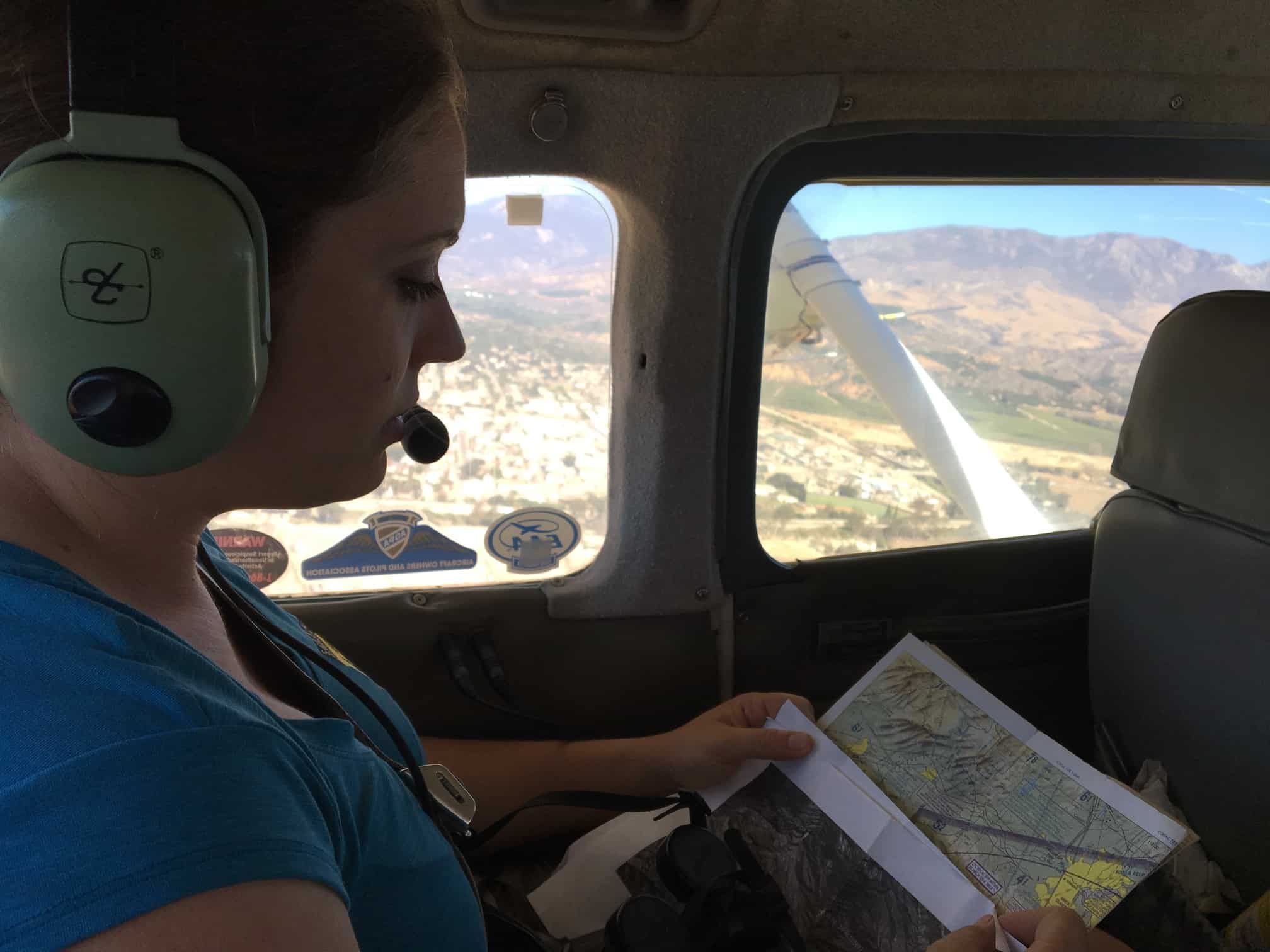
LightHawk is working in collaboration with the Sonoran Joint Venture (SJV) to give wings to the conservation efforts of partners like you. LightHawk was founded in 1979 by a bush pilot from New Mexico who believed that if others could see the degradation of the landscape that he witnessed from the cockpit, more attention would be paid to environmental protection. By leveraging a network of almost 300 volunteer pilots to provide more than 400 flights each year, LightHawk helps partners to solve the most important conservation problems coast to coast, designing flight campaigns with qualified environmental partners, and recruiting the very best pilots that meet our rigorous requirements. These flight campaigns foster dialogue and build consensus, promote informed decision-making, and increase the efficiency and effectiveness of conservation work. LightHawk stands ready to leverage the aerial perspective into big conservation wins.
What kind of big wins?
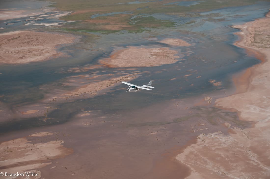
In 2009, when conservation organizations including Sonoran Institute asked us to help them to reunite the waters of the Colorado River with the Gulf of California, LightHawk was eager to fly in support of this major effort. Sonoran’s work, facilitated by LightHawk flyovers that drove home the extent of damage to the river basin — and the potential for fixing it — resulted in a historic agreement reached between the United States and Mexico to promote the health and extend the flow of the river. The waters of the Colorado River and the Gulf of California met again after a 16-year divorce. We celebrated this historic reunion born of more than five years of work and 100 flights on May 14, 2014 as LightHawk pilot Bob Allen guided Sonoran’s Francisco Zamora Arroyo above the tidal nexus.

“From the air, it all starts to make sense,” says Francisco Zamora Arroyo (Director, Colorado River Delta Program, Sonoran Institute). “Parcels of seemingly fragmented land miraculously stitch together. With the help of LightHawk, we are able to see the Colorado River Delta as a whole. While our projects cover many parts of this region, it is from the air that their connections are truly understood.” LightHawk donated flights and professional services to this restoration effort valued at more than $115,000 and volunteer pilots like Bob Allen contributed their aircraft and expertise to this herculean effort without charge. LightHawk flights also helped to convince major funders such as Tinker Foundation to support Sonoran’s work in the Colorado River Delta.
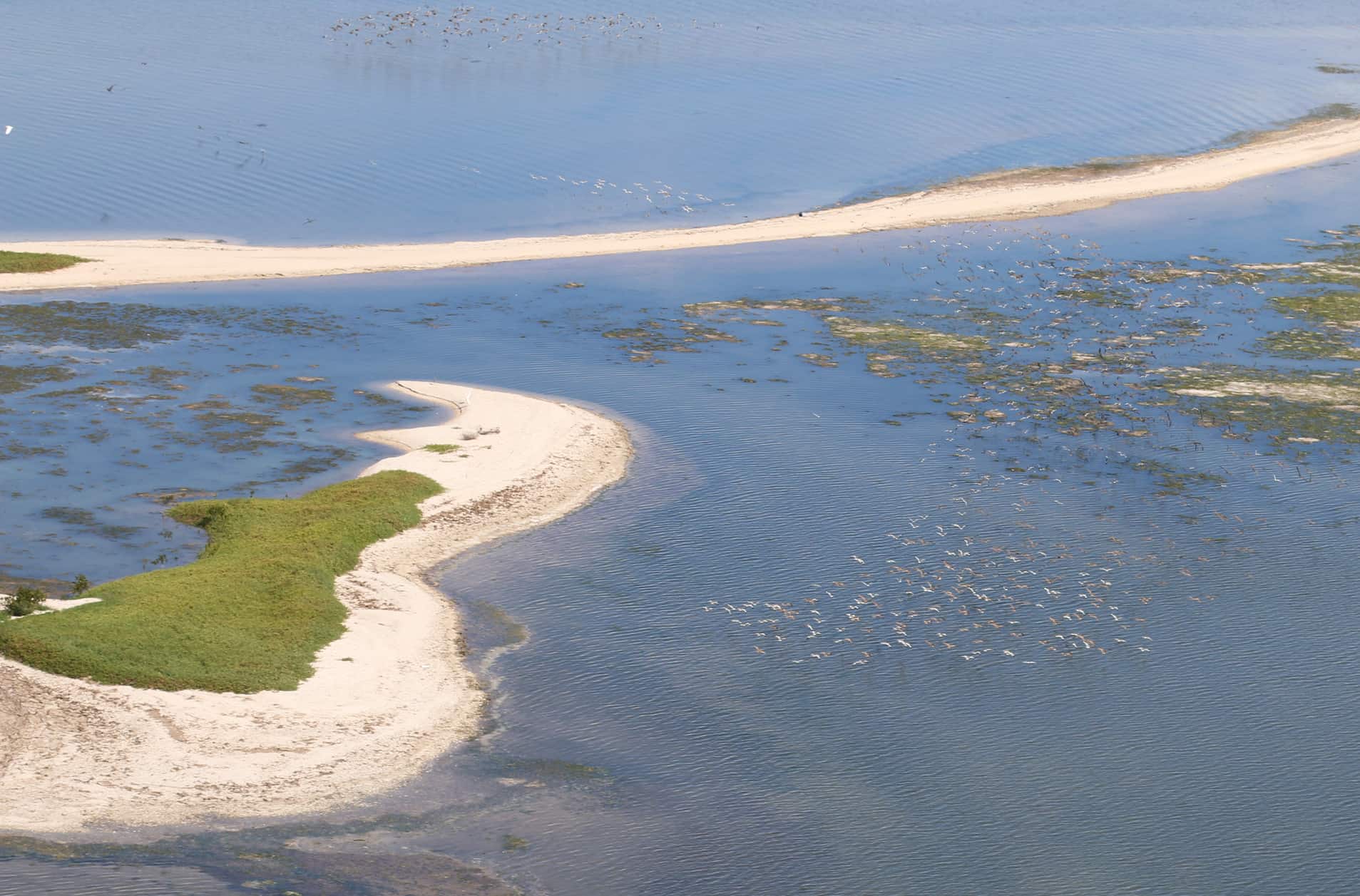
Flights help partners enhance understanding of interconnected natural systems – in this case, the river corridor, wetlands, tidal zones, shifting sand bars and arid desert plains. A single flight can make it clear to donors, local officials and community members how all the pieces fit together. LightHawk continues to work with Sonoran Institute, Raise the River, and other partners to measure and monitor work restoring the expansive, but dehydrated Colorado River Delta where nutrient-rich waters once supported a thriving fish nursery and acted as an important refuge for migratory birds.
Landscape-scale conservation is important, but it can also be difficult work. At LightHawk we help organizations to reveal the grand scale of their work and to change hearts and minds through the aerial perspective. LightHawk has a long record of flying to support birds and their habitats and is well positioned to support SJV partners. During the past year LightHawk has been involved in number of avian-focused projects in areas where SJV partners work including:
Species Survival support for California Condors
LightHawk partners with several members of US Fish and Wildlife’s California Condor Recovery Program. We have supported the program in Pinnacles National Park with aerial telemetry flights since 2014, and this year expanded that effort to monitor a separate flock around the Sespe Wilderness with the Santa Barbara Zoo. Regularly locating the condors is critical to monitoring their health and to their recovery. “We monitor condors from the ground but with LightHawk pilots helping from above, birds can be located more quickly and efficiently,” said Rachel Wolstenholme, Condor Program Manager, Pinnacles National Park. LightHawk also transports Condors for genetic diversity in the captive breeding program and helped to track Condors when smoke from the Soberanes wildfire in the Big Sur area limited ground tracking.
Aerial Surveys of Shorebirds
LightHawk supports two studies that provide important information about Mono Lake in the eastern Sierra Nevada, a vital resting stop for migratory shorebirds, and breeding site for California Gulls. Since 2008, LightHawk flights have enabled the Mono Lake Committee to participate in ongoing research studying migrating Eared Grebes in partnership with Canadian ornithologist Dr. Sean Boyd. LightHawk survey flights over Mono Lake this year included aerial photography surveys (calculating peak abundance) as well as aerial telemetry surveys (determining presence and location). These data will be analyzed to describe migration patterns, and will provide a good indicator of habitat conditions for other similar, wetland nesting species.
LightHawk has partnered to advance one of the longest term ongoing studies of birds in North America by helping Point Blue Conservation Science with a study that they began in 1982 to monitor the population size and reproductive success of California Gulls at Mono Lake. The study assesses the conditions at Mono Lake and how the gulls respond to long-term environmental change. Aerial photography surveys over Mono Lake, modeled after Dr. Boyd’s Eared Grebe protocol, have now enabled researchers from Point Blue Conservation Science to count nesting California Gulls entirely from the air. Previously, scientists estimated population size through ground counts, which were highly disruptive to the gulls as they were temporarily flushed off their nests. “In 2015 and 2016 we conducted both ground counts & aerial photography surveys to test how the 2 methods compared – and found aerial photography matched our ground count results by about 97%,” explained Kristie Nelson, project lead, Point Blue Conservation Science.
LightHawk has been flying with a diversity of partners in the Sonoran Desert for decades and has realized significant outcomes with many. Regional partners include those described above plus Centro de Investigación Cientifica y de Educación Superior de Ensenada (CICESE), Pronatura Noroeste, A.C., Bird Conservancy of the Rockies, Tucson Audubon Society, Sonoran Institute, The Nature Conservancy, and U.S. Forest Service, and more.
Contact Western Program Director Esther Duke to learn more about how LightHawk can help advance your conservation campaigns. Flights are made available at no cost to partners. LightHawk pilots are based throughout the United States. We also provide limited support for missions in parts of Mexico.