By Sula Vanderplank, Project Coordinator, San Diego Natural History Museum
Do you ever wish you could see a snapshot of current knowledge about the biodiversity of an area? Wouldn’t it be great to have maps that show how many species we already know to occur in different regions, or perhaps you would like see how many species are endemic or protected? What about knowing what areas people are currently targeting for conservation efforts so that we can identify holes in our current protections?
That’s exactly what the San Diego Natural History Museum (the Nat) is attempting to do with an ambitious new project to pull together all the easily available and existing data about the biodiversity of the Baja California peninsula. This effort began in June 2017, when the Nat received a grant from the Jiji Foundation (via the International Community Foundation), and began a yearlong collaborative project to strengthen the understanding of the status of research and conservation efforts in the region. This project aims to put in one place all the information that we have to date about the distribution of species in the peninsula, and make it publically available online through maps and GIS files, as well as kmz files that can be used in GoogleEarth. The project involves numerous collaborators from Baja California, as well as the National Commission for Biodiversity (CONABIO) in Mexico City. The project is dived into two phases, and includes data on the birds, plants, herpetofauna, mammals, scorpions and freshwater fish of the peninsula.
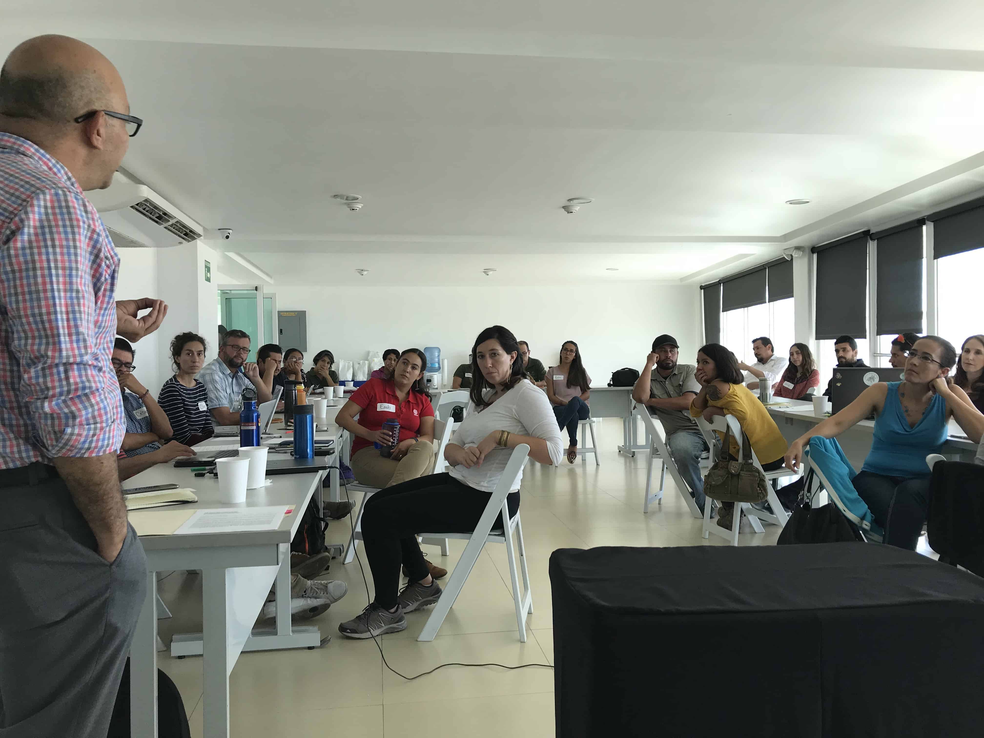
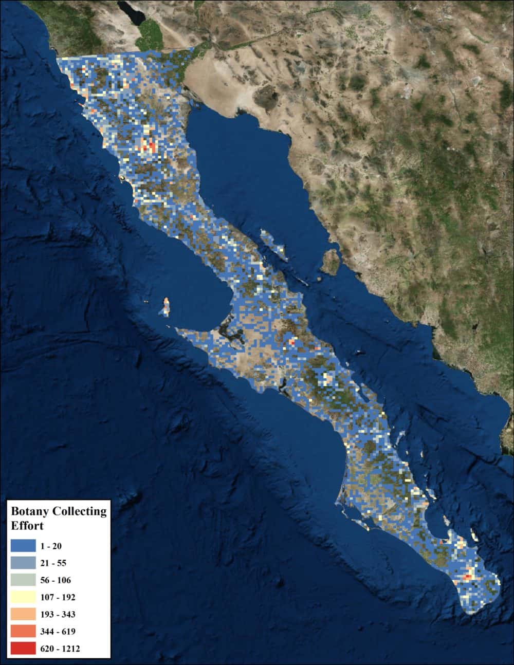
During the first phase of the project, numerous workshops took place (in Ensenada, La Paz and San Diego) in collaboration with Terra Peninsular, Ecology Project International, and Paulina Godoy to combine expert opinion with the data that were gathered and compiled. The data were harvested from museum collections, iNaturalist/Naturalista and eBird sightings that are curator verified, as well as private data sets from individual researchers. More than 100 people have participated in the workshops so far, and more than half-a-million georeferenced data-points have already been incorporated for the peninsula. For each group of organisms, we have mapped the total collecting effort, total biodiversity documented, as well as subsets for native, non-native, endemic, federally protected and IUCN-listed species as appropriate, in addition to species on the Mexican Endangered species list (NOM-059-SEMARNAT-2010). These maps were reviewed and corrected by groups of taxonomic experts in each state. We have already generated more than 40 different maps to reflect our knowledge of the biodiversity of the peninsula. These maps allowed us to start to evaluate the biological geography of the peninsula. For example, we could identify:
- Regions of particularly high endemism and/or biological diversity
- ‘Black holes’ of biodiversity knowledge
- Areas historically documented but with limited recent knowledge
In the second phase of this project, we compiled the regional priorities of the conservation community gathered from the workshops and digitized their current areas of focus to create workmaps for the peninsula. The biological information collected during the first phase will be made available to the entire conservation community by allowing for the download of data layers. In addition, the biological data will be overlain with spatial data for the political geography. By combining these data, we plan to provide tools that various research and conservation organizations might use to help them achieve their organizational goals. The project will culminate with a bilingual report that accompanies the online mapping resources, and will be widely distributed within the binational conservation and research community in the California’s and beyond. The report will be available for free download on the Nat’s website, along with the GIS/Google Earth layers publicly available via DataBasin and the national data repositories of CONABIO.
In the future, we hope to repeat some of the conservation assessments that CONABIO has conducted at a National level, but for the peninsula only, using these new community driven and verified data sets to refine the assessments with more biological information. These assessments will require distribution polygons and/or modelling of species ranges to give a less biased view of the biodiversity of the region since our point data only reflects limited sampling effort and does not include any absence data. If you would like to get involved in future phases of this initiative, please contact Sula Vanderplank for more information.